Dedh Cans ha Pemdhek
De Meurth, pempes warn ügens mis Ebrel
Tuesday, 25th April
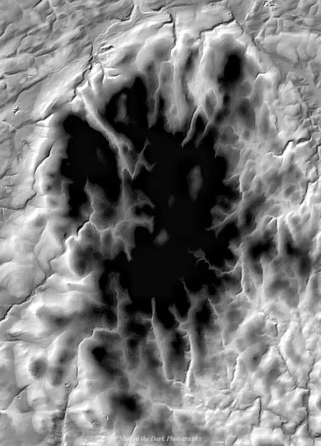
My a weles pictour warbydn ûsadow war Facebook, ow tisqwedhes radn Dartmoor en Pow Densher. Thewa pecar'a menedh tan. Kemerys ew dhort ayrplayn gen teknologieth nowydh henwys LiDAR - ow ûsya laser dastewydnys dhort enep an dor ha dowr (heb glasneth). "My a wra whilas ymajys a'n par na a Gernow," my a brederas. Otta an Tiredh Prei my a drouvyas. Garow ew an dor. Dhort lòren whei ell gweles an prei gwydn. Gen LiDAR whei ell gweles an crigow atal ha tollow.
I saw an unusual picture on Facebook, showing part of Dartmoor in Devon. it's like a volcano. It's taken from an aeroplane with new technology called LiDAR - using a laser reflected from the ground and water surface (without vegetation). "I'll look for that sort of image of Cornwall," I thought. Here's the Clay Country I found. The ground is rough. From a satellite you can see the white clay. With LiDAR you can see the slag heaps and pits.

.png)
.png)


Comments
Post a Comment